Railway Walk Heritage Trail
This is one of the walks within the first batch of Heritage Walks created by Baildon History Society and commissioned by Baildon Parish Council.
The Heritage Walks page has details of how you can get a copy of this walk.
The Railway Walk
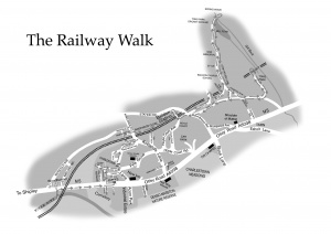
(Distance: about 5 miles or 8 km.)
The railway sweeps through lower Baildon, on its way from Bradford and Shipley to Guiseley and Ilkley, crossing the River Aire by a substantial stone and metal bridge at Woodbottom and leaving by the great viaduct over Gill Beck at Tong Park, forming the north-western boundary of Charlestown for much of this distance. This walk follows that route, noting many diverse points of interest along the way – and not just about the railway.
Where to start
Perhaps the title of the walk implies you ought to arrive by train and begin at Baildon station, but we start the walk at Woodbottom where the railway crosses the River Aire from Shipley.
The Railway Arch at Woodbottom
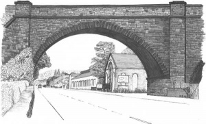
When you get to Woodbottom, have a look at the information board near the bus stop at the shops: this tells you many of the points of interest in the locality, not all of which are covered in this walk. Opposite the shops there used to be a park. It was called Roberts Park because it was given by Bertram and Eliza Roberts to the children of Charlestown and Woodbottom in 1910. It was sold by Baildon UDC in 1952 to W. P. Butterfield Ltd for them to expand their engineering works. They made tankers.
Cross the road from the car park and, just before the railway arch, turn right down a snicket which leads to a footbridge across the River Aire. From there you can see the full extent of the Charlestown viaduct: there are six masonry arches of 45 and 47 feet span, and one metal span of 110 feet. It was opened in 1876. On the far side of the river, Dockfield Road is favoured for fly tipping distressingly often. It is not a new problem: the Baildon Board minutes record that the Nuisance Inspector ordered one Thomas Brook to remove the night soil and other rubbish he had deposited between the railway arches at Charlestown viaduct in 1884!
Return to Otley road. Just opposite, a log and brick ‘cabin’ built for the viaduct construction workers used to be situated, at the bottom of Midland Road: ‘Bridge Cottage’. It was used as a residential dwelling until the 1960s, and a Mr Cameron and his family lived there until its demolition (they paid 12/- (60p) a week rent when they moved in). He was a railway engine driver and is still (2009) living, well into his eighties. The house was also used at one time by Ferniehirst estate workers.
Now turn right, under the bridge, and make your way along Otley Road from where, across the road, the line of the railway can be seen curving round beyond the allotments. Another walk leaflet (The Turnpike Walk) describes the many other points of interest you may see in this part of Charlestown, but you may note in passing an old milestone on the pavement (we shall see its twin later). Cross Otley Road at the zebra crossing at St John’s Court. This is the centre of Charlestown, and a separate walk leaflet describes the features of interest here: The Charlie Thompson Walk.
A look back over Charlestown allotments
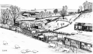
Walk through between the shops to the little courtyard at the back. To the left of the parking area is Rosemont Lane leading uphill: follow that to Dewhirst Road and turn left, opposite Ivy Bank Court, and continue until the road curves round to the right, where there’s a view back over the allotments to the Charlestown viaduct, and children may also find interest in the farm livestock often to be seen here.
From Charlestown to Baildon Station
Then walk back along Dewhirst Road to Fyfe Lane and turn left up the hill. At the top, don’t swing right into Park Mount Avenue: go straight on towards some garages and turn right into a level track at the back of Park Mount Avenue, with its black and white gable ends on this side as well as the front, perhaps for train travellers to admire.
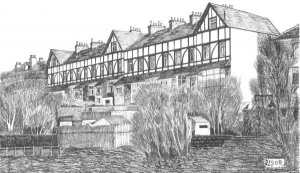
Here there is a footbridge across the railway, but before crossing it, go along the level track (Upper Fyfe Lane) behind these houses parallel to the railway until you come to the road which crosses the railway here. Opposite on the left is a row of cottages called Crofters Cottage (the nearest) and St Helena. They used to be three cottages called St Helena where in 1912, according to the Post Office directory, a signalman and station master were living at numbers 2 and 6 – respectively William Weston and George Tideswell. The latter was station master at Baildon from the early 1900s: his family has a photograph of him with his family outside St Helena in 1909. (In 1894 there was a railway inspector, James Chambers, living elsewhere in Baildon in Green Lane).
Come back to the railway footbridge, which is the only one of this type on this stretch of line, cross the line and turn right into Hawthorn View. Go to the end and cross Kirklands Road, taking the little snicket immediately opposite, which leads into Ridgewood Close, from where you can see the railway again. Follow this road to the station. This road and the houses were built in the 1980s on the site of the railway sidings.
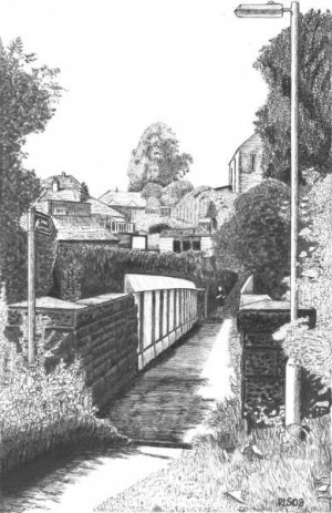
The Midland and North Eastern Railways combined to build the Shipley, Baildon, Esholt, Guiseley line in 1876 to link up to their Otley and Otley Joint Railway of 1865. From 1923 these lines became part of the London, Midland & Scottish Railway (LMS), with the forming of the ‘big four’. These all became British Railways in the nationalisation of 1948. Experts from all over the world came to see this line when it was completed in 1876. It was considered a great feat of engineering, with the viaduct over the River Aire at Charlestown, then the cuttings and tunnels from Baildon to Tong Park emerging to a magnificent viaduct standing at the top of Tong Park village. (Distance from start to station: about 1.2 miles or 2 km.)
Baildon station was opened on December 4th 1876. As now, the railway was important for passengers, especially for commuters to Bradford before the coming of the motor car. There were six trains each way plus an extra train from Ilkley at 9.10am on week days. In 1891 Baildon Board asked the Midland Railway Co. to put on an early morning train ‘for the workpeople who were compelled to seek work in the neighbourhood of Bradford’. In 1894 a deputation asked Baildon Board to urge the Midland Railway Company to continue the 5.40am train to Bradford and to issue season tickets at £1 each so that more would be bought from Baildon instead of people walking to Shipley. On Sundays there were two trains each way. In the 1920s there were 900 regular pass holders. Family photographs show Mr Tideswell on the track at Baildon station with six staff in the early 1900s, and in the mid 1920s with seven staff. His eldest son George became station master at Clayton West (near Huddersfield).
Two incidents occurred on the railway at Baildon, both brought about by the steady climb of 1:102 from Charlestown viaduct up to the Baildon tunnels. In the late afternoon of 24 November 1947 two trains collided above the gardens of Midland Road. The 5.00pm Bradford Forster Square-Morecambe express, having been diverted this way (i.e., via Guiseley and Ilkley to Skipton), stalled on the gradient. It was run into heavily from behind by the following 5.10pm Bradford Forster Square-Ilkley train after its driver passed a signal at danger. (He was possibly going to assist and misjudged it.) The engine of the second train was derailed and the last carriage of the Morecambe train was severely damaged, with 20 injuries.
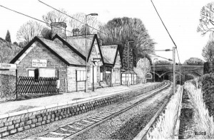
Second, during a dry spell in May in the late 1950s, a hard-working engine threw a spark which caused a line side grass fire just south of Baildon station. This was sufficiently serious, affecting both sides of the line, to involve the local firebrigade and seriously damage the British Rubber Company’s lorry which was parked there.
The station was closed on 3 January 1953, though it opened again in January 1957 for three months at the time of the Suez crisis when petrol was in short supply. However, the line survived the Beeching closures of the 1960s and after much campaigning the station was reopened on 5th January 1973 with, as the Shipley Times & Express put it, ‘a brass band, pretty girls with colourful banners and a large cheering crowd of over 200.’ A special train was met by local dignitaries including Councillor Arnold Lightowler, who clipped a huge specially-made ticket. The fare to Bradford was 13p and to Ilkley 17p. From that time on it has been an unmanned station: tickets have to be bought on the train.
The line was originally double track, but was reduced to single track between Shipley and Guiseley in 1983. The old platform, now overgrown and a haven for birds and other wildlife, can still be seen opposite. It was reached by a footpath from Hoyle Court Avenue and a small gate, but originally there was an iron footbridge with attractive lattice work hand rails between the platforms at the Bradford end of the station, and the now disused platform once had another stone waiting room. That footbridge and waiting room were demolished soon after the line became single track (1983). The line was electrified in July 1995, having received government approval for electrification in November 1990.
The railway sidings were where Ridgewood Close now is: there was also a goods shed. Messrs J S Whitaker, coal merchants, worked from the railway goods yard, and there was for a time in the 70s a small refrigerated depot for local milk deliveries. The British Rubber Company operated from the sidings when it first established its tyre business in Baildon after the Second World War. It still operates from the station yard, using the old station buildings for its office. Though the windows are boarded up on the platform side, the station building is in typical ‘Derby Gothic’ style of the Settle-Carlisle line stations, a Midland Railway single-storeyed structure with two gabled pavilions and decorative bargeboards – the latter have since been replaced with plainer facia boards – and chimneys for the days when the waiting room, etc., were heated with open fires. On the now disused platform, there was a signal box which was closed in 1956. The Baildon Board (on 23 Dec 1884) requested that the station be lit by gas lamps, and the gas was supplied by The Shipley Gas Light Company. When the station was reopened during the Suez crisis, the platforms were lit by Tilley lamps because the gas supply had been cut off by that time.
As well as passengers, in the early days the railway carried freight. Limestone was carried from quarries near Skipton in Craven and Horton in Ribblesdale to Baildon station for use by Baildon Local Board on the roads by the mid-1880s (at the same time as it was being delivered by canal). In 1891 the Board ordered seven trucks of broken Ingleton granite, and Low Baildon Road (now Station Road) was to be coated with granite. Coal from Baildon Moor was transported to Wharfedale by rail, being cheaper than horse and cart. However, better quality coal was imported into Baildon from outside the area and this ultimately resulted in the closure of the last Baildon Moor pit at Lobley Gate before the end of the nineteenth century. The railway also transported geese which came to Baildon from Ireland in crates for the catering trade run by a Mr. Hutton. (In November 1889 he was asked by the Baildon Local Board of Health to keep his goose yard cleaner!)
Houses were soon built within easy reach of the station. It has been said that because of the railway there were more millionaires living in Baildon than anywhere else. Some of the middle-class houses can be seen nearby. From the platform, just by the car park, look across and to the right and you will see, even in summer when trees limit the view, part of a tall row of older town houses on the far side of the line and at right angles to it. This is Kirklands Avenue which had already been built by the time of the 1901 Census: you can see the black and white gable end of the last house. Further away you can just see the chimney pots of Park Mount Avenue, which we’ve already passed – it only had one house by 1909, but had been completed by 1922. This was the age of the train, and none of those houses was built with a garage (though some have now been put up in back gardens, and of course the more modern houses of the Hoyle Court estate, immediately opposite, all have their own garages). Walk to the other end of the platform, to the stone footbridge over the line. Turn up left to the main Station Road (formerly known as Low Baildon Road). On the left hand corner is a large detached house called Ashleigh, built in 1887 as indicated by the datestone visible from the handsome gates.
From Baildon Station to Tong Park Viaduct
Return to the footbridge and cross the line, and immediately turn left down the steps to a footpath, parallel with the railway, past an old stone house in a hollow on the right – this is Hoyle Court Cottage. The footpath broadens into a lane as you approach Grey Gables. This lane was once owned by the railway who wanted to sell it. The owner of Grey Gables declined to buy it and it was sold to Hoyle Court Cottage with a public right of way to the station.
Continue to the end of the lane where it joins the main road. You will see the railway bridge on your left. This is Roundwood Road which you must now cross: go round the corner to the right and a little further down the road where the visibility is better, and proceed across with due caution. Come back up the hill and turn right up into Langley Lane. Continue up and round to the left (past Hollin Head) – you are crossing the railway line deep beneath you – until you come to Littondale Close on the right. This sign indicates only a path to a short row of houses, not a road, and it’s signposted also as a public footpath. Follow this footpath for a short stretch until it turns right where, after a few yards, you can crane your neck over the fence and foliage on your left for a view of the entrance to the second of two tunnels which take the railway under Langley Lane and the higher ground ahead. The houses above it are on The Paddock, which we shall pass in a moment.
Continue along the footpath, which first turns left to run parallel to the railway and then right as it emerges at the top of Hollin Head. Turn left, pass The Paddock with its houses over the tunnel on the left, and then turn left into Lonk House Lane, another signposted public footpath. (The Lonk is one of the largest native hill breeds of sheep in the Pennines.) The houses on the right of this lane were built at the millennium on the site of the demolished Tong Park Hall which was the home of the Denby family and, more recently, used by Bradford Council as an assessment centre for young people.
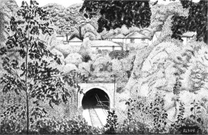
Look out for the information board on your left in the grounds of the Baildon Church School – which used to be Ladderbanks Middle School under the three-tier education system which reverted to the old two-tier system early in the new millennium. The board tells you about some of the historical and natural features to be seen in Tong Park village and the surrounding countryside, many of which we shall see. The link with Tong (a village just south of Bradford) is said by Philip Baxter to date back as far as Norman times to the Anglo-Saxon descendants of Ulf a landowner whose son Essulf owned land at Tong according to Domesday Book and whose grandson Richard (senior) was named de Tonge and whose great grandsons Richard and Hugh owned land at Tong and Baildon – Hugh being the first ‘de Baildon’.
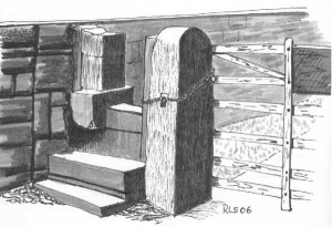
Clamber over the stile and continue along the track which starts to wind down the hill until you reach the War Memorial, where there opens before you a majestic panorama: at the bottom of the slope is Tong Park mill dam and Tong Park cricket ground, with Spring Woods further up the valley, parkland-style grazing land on the left, golf course to the right, and in the distance Ilkley Moor. The area is rich in wildlife. The fields contain a wide variety of flower species such as spotted orchid, betony, yellow rattle, marsh marigold and bulrush. Glacial moraines, rich in limestone, explain the occurrence of some unusual plants in the area. In Spring Woods are carpets of bluebells and other woodland flowers such as wood anemone and cuckoo pint. Late summer sees butterflies and dragonflies on the wing. (Distance so far – to war memorial: about 2.1 miles or 3.3 km.)
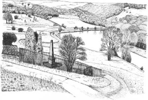
The cricket pitch is well worthy of note, sitting as it does in a natural amphitheatre which in 1914 accommodated a crowd of 3,000 for the cup tie against Windhill (takings for the day were £27). Tong Park Cricket Club started in 1880. According to the late Sydney Jackson the club’s first pitch was in the field at the corner of Buck lane and Otley road which was levelled by using debris from the next field down the lane which was part of a terminal glacial moraine. Their second ground was close to Tong Park Hall. The present ground is their third.
The Tong Park war memorial lists the names of 20 Tong Park men killed in the First World War (1914-18) and two in the Second World War (1939-45). It was erected in 1922-3 and paid for by the Denby family, who first came to Baildon in 1853 when William Denby junior, of William Denby and Sons, bought Tong Park Mill with 200 acres of land. The first Tong Park Mill dated from about 1778. It had a succession of owners and became known as Gill Mill. William Denby extended the mill (and put in a bigger millpond), making and finishing worsted cloth until the 1920s. The machinery was powered by steam engine. Later the firm started in specialise in dyeing and finishing, and especially shower-proofing (including ‘Denbirayne’, for which they became famous) until they closed down. The old stone buildings of the worsted mill have been demolished, and what remains is fairly recent. However, one of the chimneys carries a reminder of the past: the Denbirayne trade mark. This is post 1926 when there was a fire, after which the mill specialised. The Denby family built a small model village complete with workers houses, co-op, institute and Methodist chapel, parts of which we shall see later.
From the war memorial follow the track down to the millpond. Before the entrance gate to the cricket field you’ll notice some recently made brick arches through which water from a spring flows. Continue past the cricket field gate, cross a concrete bridge over water channelled from Gill Beck to feed the millpond, and through a wooden gate to another bridge which crosses the beck itself. From here you will see the viaduct, a much-admired feat of engineering when it was built in 1876. (Tong Park Mill lies out of sight behind it.) The railway here crosses the Gill Beck valley, which is the boundary of Baildon, and passes Esholt village which used to have its own station, and on to Guiseley and Ilkley.
Having admired the viaduct and enjoyed the millpond, toil back up the hill to the war memorial. (Distance down to viewpoint and back: about 0.5 miles or 0.8 km.)
Round by old lanes
Go back up the road over the stile and along Lonk House Lane. At the tarmac road (Hollin Head) go straight across and down the lane towards Oak Place and Primrose Row. Notice the old back-to-back cottages of Oak Place on the right, a single block with odd numbers on one side and evens on the other, but take the left fork down Primrose Row, past the row of old cottages on the left and some newer houses on the right. At the bottom on the right is the old Wesleyan Methodist chapel paid for by the Denby family: this opened in 1869 and closed in 1959. It became a private house after having been used as a boat building site for a time.
If you’ve had enough, you can miss out the next bit and head back to the start. You’ll save about a mile (1.7 km.). Turn right at the old chapel and go along the level road called Park Lane, as described in the last two paragraphs of this Walk.
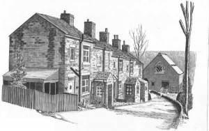
Otherwise, continue on down to track to the left of the old chapel, and at the next fork turn left and follow it past an attractive old house called The Beeches on the left, opposite Woodlands and The Coach House. This is Tong Park, and here a cobbled track starts which you follow round and up the hill, ignoring for the moment the track down to the right which leads behind the industrial estate where Denby's mill used to be.
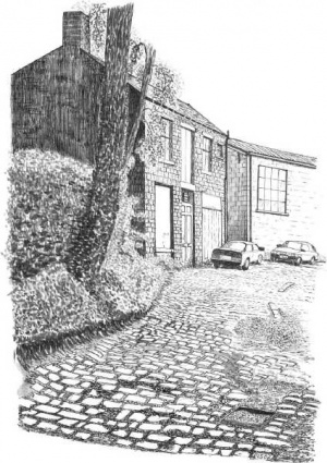
Continue up the cobbled track until you see the boarded up old co-op on your left with its ‘taking in door’ above, just downhill from the car maintenance workshop. This is where the old village of Tong Park Street used to be, built (on a glacial moraine) by the Denby family. It included its own co-op, institute and chapel which was also a Sunday school. The Tong Park Street houses were demolished for public health reasons in the 1960s, and all that remains is the co-op.
The track ends at a gate where you might if you’re lucky see a train passing not far ahead. Retrace your steps down the track, to the fork which you passed on the way up (now on your left). This shaded old lane goes past Denby’s Mill which you can see down on the right with two tall chimneys. One chimney bears an advert for Denbirayne, which is the only reminder left of the old mill. It is now an industrial estate. Follow the lane along until it does a U-turn up to the left to a garage workshop: you go straight on for a few yards until you find a rough path on your right which leads down and under the viaduct. Be careful, it’s rough and can be slippy.
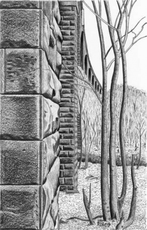
Once you reach the viaduct you can stand underneath it and appreciate the scale of the structure. There’s a quarry up on the left beyond the viaduct, which may well have supplied the stone. Note the two huge buttresses on the far side on your left, one of stone and one of concrete, and the brick above you under the arches as at Woodbottom. Some of the bricks lying around have ‘Shipley’ stamped on them, and this may indicate that at least some of the bricks in the viaduct came from the brickworks of John R Fyfe & Company in Shipley which made bricks for furnaces, but also built two brick semi-detached houses in Shipley to display their wares. Other bricks are stamped ‘BBT’ for Bradford Brick and Tile Company. Note also the remains of the millrace (now dried up) from the millpond: its route can still be followed, passing under the viaduct to the old waterwheel pit. Below you is Gill Beck in a steep little gorge. (Distance from start to viaduct: about 3.3 miles or 5.3 km.)
Retrace your steps up the sloping path, along the shaded land, through the Tong Park houses and round to the right until you come to a fork in the lane: turn up right, back to the old Methodist chapel. Continue past the chapel on the level road called Park Lane, with modern houses on the right, with large flights of steps up to their front doors. Continue along this road and admire the long views across to Idle Hill with its radio masts (or Wrose Hill as locals often call it), and Buck Wood. You also gain fine shorter views into many well-kept back gardens.
Reach Roundwood Road, cross it and turn up to the right. Round the corner and just before the railway bridge turn left into a residential drive. Follow this and then a snicket, (the railway line is on your right). Cross the line when you come to the footbridge, and there you are back at the station. (Distance for those began at Woodbottom: about 4.1 miles or 6.5 km.)
If you came by bus or car to Woodbottom, return by the way you came, or follow the instructions at the beginning of this Walk (‘How to get there’). It’s about 0.8 miles or 1.3 km., so if you began here at the station you’ve walked about 5 miles (8 km.)